Biking from Point Pleasant to Island Beach State Park

Description:
This route is all along a narrow sand spit, and mostly on the only highway. It connects the two big Jersey boardwalks in this part of the state -- Point Pleasant and Seaside Heights. The beaches along the way are beautiful, but mostly private and unseen from the road. The route terminates at the southern tip of Island Beach State Park, where you can look across to Long Beach Island. But you can't get there. You'd have to take a 53-mile detour inland on busy roads to cross those couple of miles of water.
Length:
This route is 11 miles if you stop at the entrance to Island Beach State Park. From there it is another 9 miles to the end.
Surface and safety:
You can take some quiet roads for the first several miles, but after that you're mostly on a major highway. However, the highway is a divided one with separate two-lane roads north and south. Each road has a wide, marked shoulder. My only complaint is that the surface of the shoulder is rough. There aren't any dangerous intersections, and the road is relatively safe, though boring.
Points of interest:
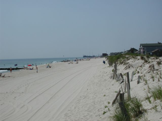
There are nice homes in Bay Head, which is the last "commuter" town on the shore. The railroad ends there. South of Bay Head is vacation land, and all the towns are named "something or other beach". The boardwalk and amusement park in Seaside Heights is a destination for many vacationers. The beaches in Island Beach State Park are famously beautiful with some of the finest white sand in the country.
What's not to like:
The highway south of Bay Head is really boring, particularly heading south. At least on the northbound road there are stores and ice cream stands. Though the beaches in Island Beach State Park are memorable, the bike path there is almost featureless. It looks the same mile after mile, and you can't see the water from the path.
Parking:
You can park most places along this route, as long as you don't need to be near the water in the middle of summer.
Photos and comments:
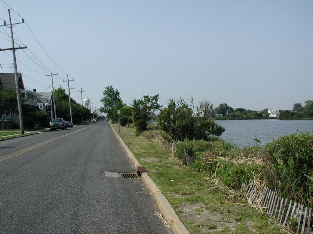
Heading south along Bay Head inland waterway
South of Point Pleasant the main highway is Route 35. Through Bay Head and a few miles afterwards, you can avoid this busy road by taking traffic-free roads a block either way -- towards the inland waterway (shown here) or towards the ocean (shown below).
A block from Route 35, the ocean front homes are on a traffic-free road
Lovely beaches in Bay Head, hidden from the road
The summer season, but these beaches are empty
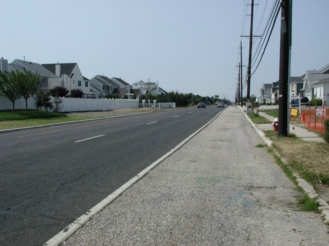
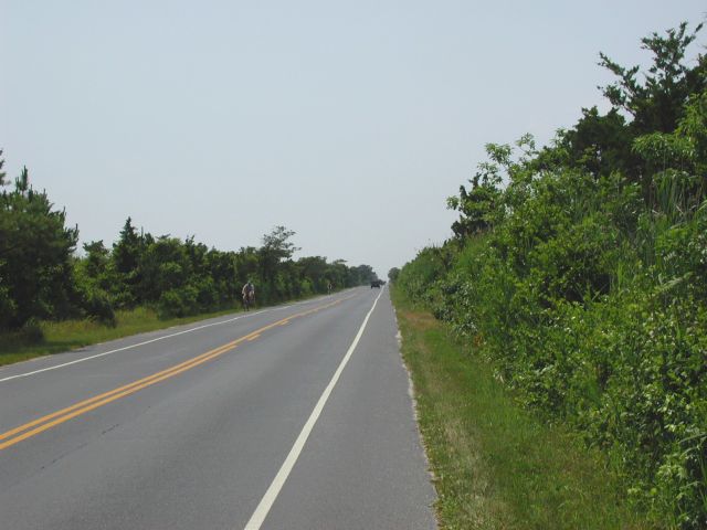
Route 35 is a divided highway south of Bayhead
This road is one-way south, and a companion road goes north. Each road has wide, marked shoulders on each side. Unfortunately, you can see that the surface of the shoulder is rather rough concrete. A little unpleasant with narrow tires.
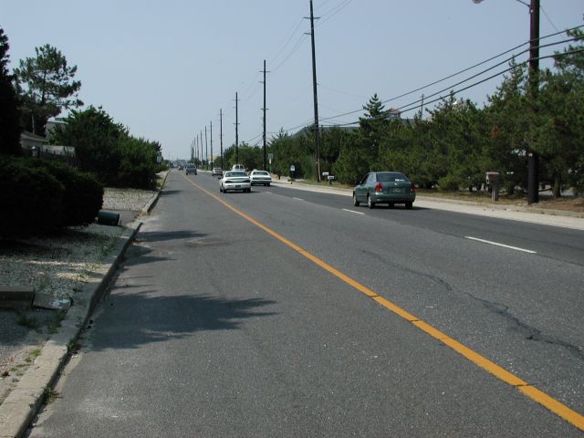
The left shoulder is smoother for a few miles
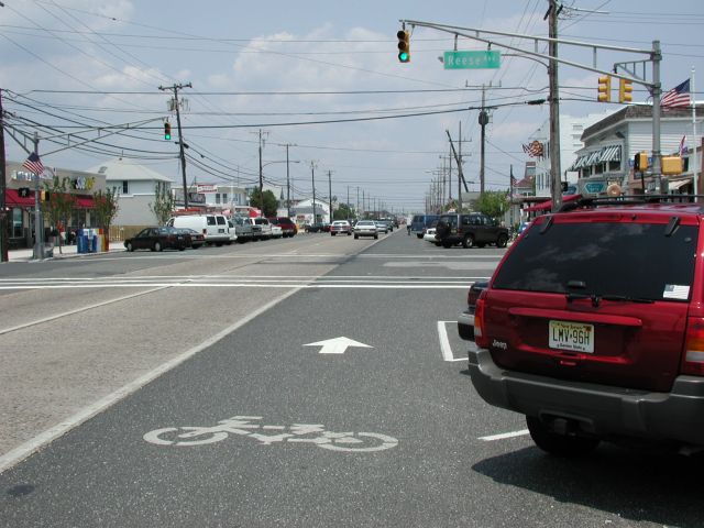
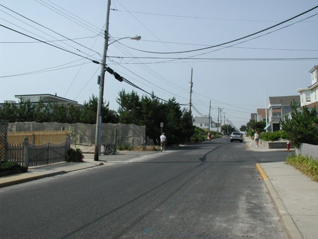
Route 35 north here has a marked bike lane, stores, and diagonal parking
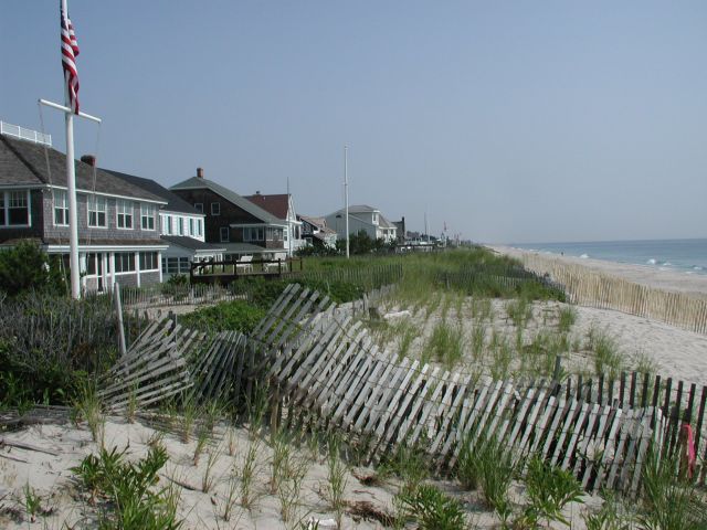
Private beaches just north of Seaside Heights
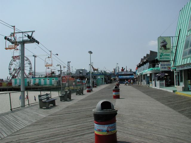
The boardwalk at Seaside Heights

Games, candy stores, and refreshment stands on the boardwalk

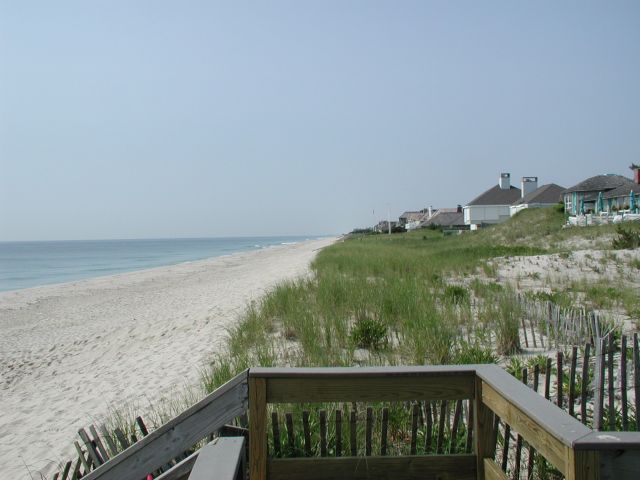
The entrance to Island Beach State Park, a mile south of Seaside Heights
The bike path south to the tip of Island Beach State Park
Back to Guide to Biking the Jersey Shore