Cycling Southwest France - Biking the Dordogne
Day 7 - Rocamadour to Cahors - 38.7 miles
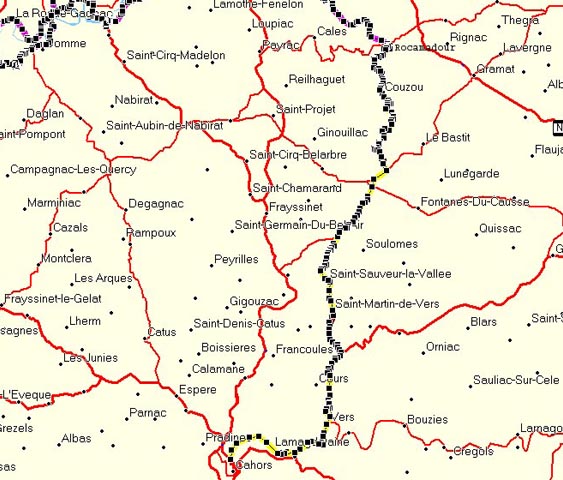
Our last day. We still were debating the route to take to Cahors, but at the last minute decided to follow the original route laid out on our GPSs, which was straight south to Cahors.
I asked the hotel lady if route D32 to the south was hilly. "A little, at first," she said. I was a bit skeptical, thinking that she lived on a cliff herself, and a road that was a little hilly might really be bad for us flatlanders.
Len took off biking up the street, and I followed shortly, but not shortly enough. Whereas Len got through to the town gate, I was blocked by a cop, that is a gendarme. He was very unfriendly, and I actually thought for a moment that I would get a ticket. You weren't allowed to bike here. I walked my bike the rest of the way to the gate.
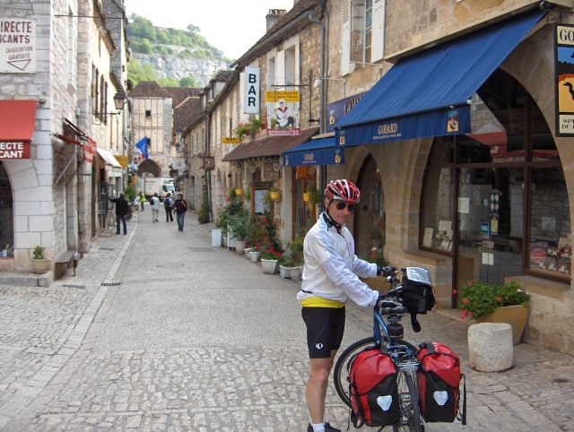
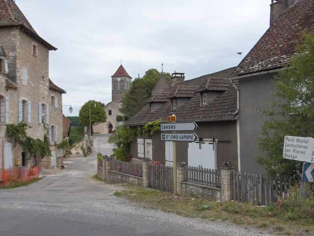
Preparing to leave Rocamadour
We coasted down to the valley below, grudgingly, as it was the only way out to the south, and began the long slog up the opposing cliff face. For a moment we paused and looked back on the vista of Rocamadour.
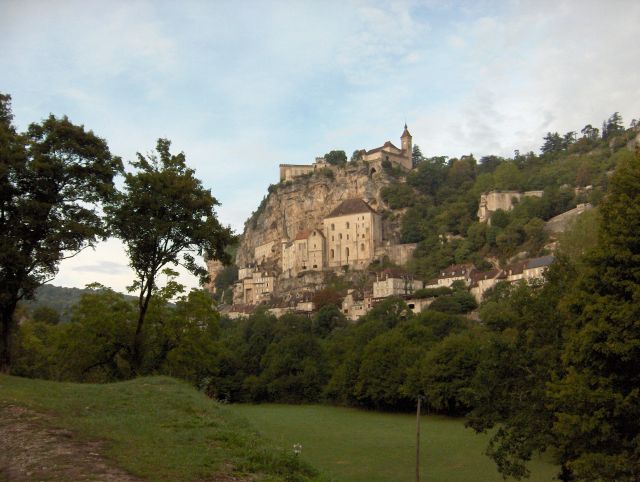
Rocamadour from the valley beneath
Partway up the opposing road, which was long, but only moderately steep, I looked across to our hotel.
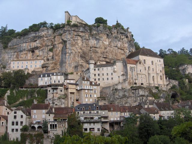
Rocamdour from the road opposite, partway up the hill
Finally I reached to top of the cliff on the other side, and started down a long hill. I knew, of course, that I would pay for this downhill jaunt. After that there was a very long hill, followed by another winding downhill and yet another long uphill. Each of these hills was more than 1000 feet in elevation.
At the top of the first of these hills we stopped to look at a farm with little lambs playing joyfully, not knowing what was in store for them in the future. They seemed so carefree and, well, young.
At the top of the second hill we reached a small village. Len was waiting for me there with his fingers making a shushing motion for me to be quiet. I stopped alongside him and listened. Nothing. I mean nothing. The village was totally lifeless. Nothing stirred. It was like out of Twilight Zone. Everyone had left or died or something. Spooky.
The quiet, spooky village
Shortly afterwards we stopped to take a picture celebrating the highest elevation of our trip.
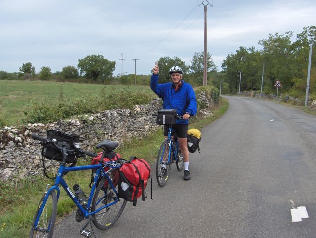
I point up, indicating reaching the highest point
Oh, but we were premature. I have two more pictures just like this one, each at an ever higher altitude. We quit taking such pictures. On the last of these premature pictures, I took a photo of Len's GPS, which recorded the elevation profile for the day, the highest point, and the total elevation gained during the trip that far along.
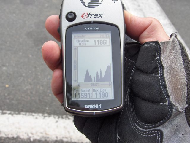
The elevation profile for the day thus far as recorded on the GPS
You can see from the jagged profile that this had been quite a hilly day. As I mentioned in the introduction, the total elevation we had gained at the end of this day (the end of the trip) was 12,744 feet. So at this time we had over a thousand feet yet to be gained.
About this time we turned onto a sort of main road with quite a bit of traffic, but a marked shoulder. It was still uncomfortable with trucks passing us at high speeds. This road had yet another long hill, at the end of which we reached what really was our highest elevation at the town of Labastide Murat, where we stopped for lunch.
There was a market in Labastide, and the town looked quite busy. We found a patisserie, but the shelves were all empty. The woman there told us something in French that I didn't understand, but clearly she had no baguettes for sandwiches. We went across the street to a cafe, which also had no sandwiches. We stood beside our bikes indecisively for a moment. Len suggested that we should go back a short ways where we had ridden past a supermarket.
I was locking my bike in front of the supermarket when Len yelled to me. "Hurry, we only have five minutes before they close!" This silly store closed at noon for two hours.
I raced into the store. The pressure was on. What could we find to eat in, now, three minutes?
They locked the store as we left with a baguette, some ham, and a couple of peaches.
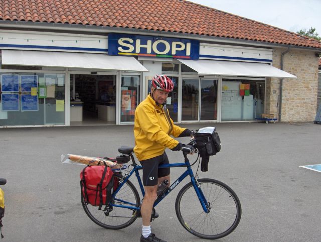
Leaving the supermarket with our prize -- a baguette
We ate lunch on a bench in front of a church. There were about 20 miles left before we got to Cahors. The morning had been strenuous, but what we didn't know during that lunch was that the remaining 20 miles would be, incredibly, all either downhill or flat.
We started by missing a turn and had to return to Labastide and take a different fork in the road. At first that road was downhill, curvy, and covered with loose gravel. I was biking very cautiously, and so was Len. There wasn't any traffic, but this was very slippery and dangerous.
Later the road went through deserted farm country. Occasionally there were herds of animals watching our progress. Nothing else.
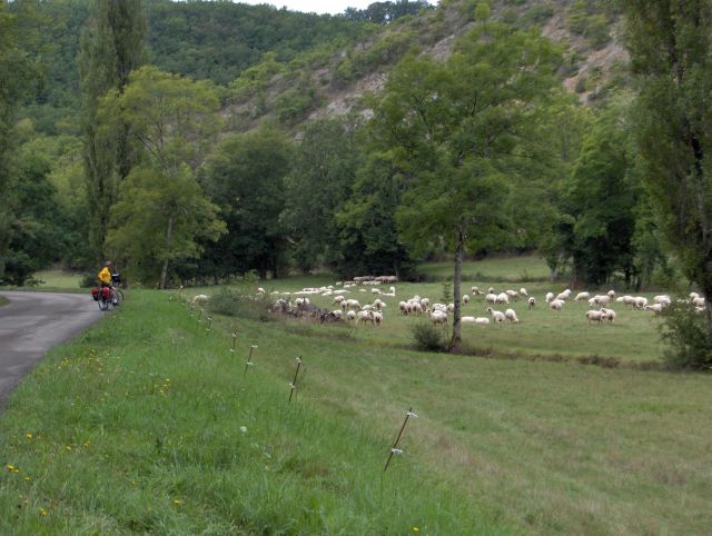
We have sheep for company
The miles flew by with nothing to mark them. This was exceedingly easy biking. For a while we followed a pleasant stream, but there were almost no towns. It seemed that the world had passed by this region. This was a road for getting somewhere else -- in our case -- Cahors.
At the town of Vers we intersected a main highway heading westward into Cahors along the river also called Vers. This was one of the two times in the trip that we headed west and felt the wind in our face. It wasn't strong, though.
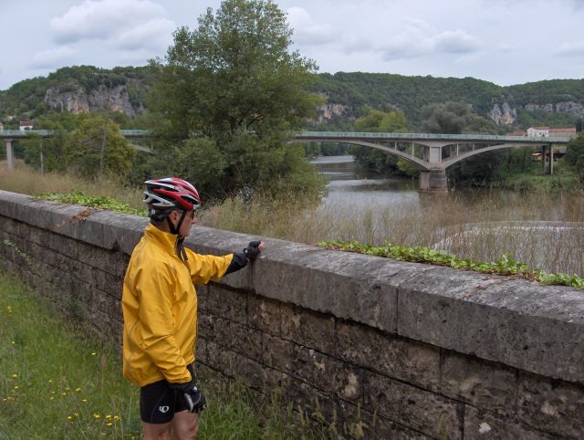
The river Vers near Cahors
This road was busy, but not nearly as busy as I had feared when plotting the route. Nonetheless, we kept as right as possible until we arrived at a bridge that marked the position of Cahors. There was a hill off to our right that we had to climb and then descend in traffic to the actual town of Cahors.
We headed straight to the train station in order to get our tickets for the morning train. We didn't think it would be advisable to be buying complicated tickets for a 5:30am train the next morning. ( In actuality, the train station was locked the next morning when we arrived to take the train.) In a combination of French and English we told the ticketmaster about the connections we needed to get to Geneva. He stopped us. "Non," he said. I didn't understand. We couldn't do that? But then he proceeded to print out the exact set of connections that we needed. I think maybe he just didn't want us to tell him what to do.
We were really happy to have our tickets.
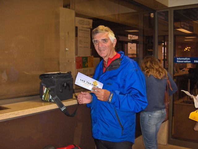
We get train tickets to Geneva, where we have a business meeting the next day
Our hotel, the Terminus, was conveniently directly across from the train station. We took a picture to celebrate the successful end of our trip.
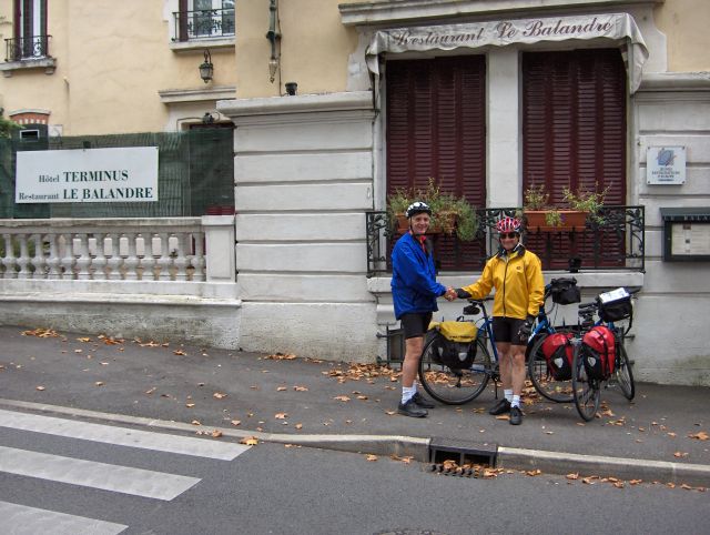
The end of our trip
We removed our handlebar bags and GPS mounts from the bikes and said goodbye to them in the hotel garage. It was a kind of bittersweet moment, sad in a way, but we had had enough of the trip. Time to do something else.
Cahors was supposed to be a good tourism destination, so we got a tour map from the hotel and went for a walk in the city. We began with a famous ancient bridge that protected the city in the middle ages.
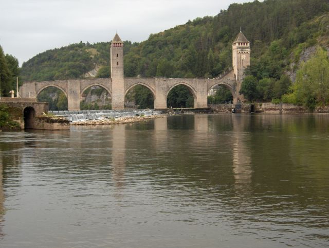
The ancient bridge at Cahors
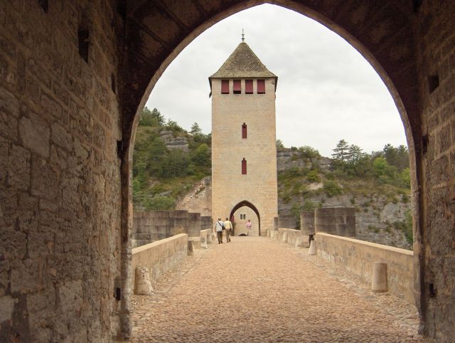
View on the bridge
From the bridge we walked across to the old town, but we were disappointed there. After seeing Sarlat, this wasn't impressive.
We walked back to our hotel along the main shopping street of Cahors, looking for a good restaurant to celebrate our trip.
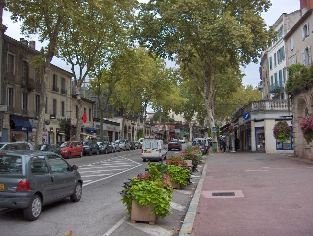
Main shopping street of Cahors
We didn't see any good restaurant, so we decided to have dinner at our hotel. However, at the hotel we checked the menu to find that the prix fixe dinner was more than $100, not including wine. The rooms were only about $50.
We walked back to the main street and ate in an ordinary brasserie. It was fine, though.
Back to the Overview Page for the Dordogne Trip
Back to Bob Lucky's Main Biking Page
And so was the trip.